
Eyes in the Sky: How Drones Are Changing Conservation
Posted on September 2, 2025
Environmental restoration has a new partner, and it is not one you would expect. Look up and you will see it: the drone.
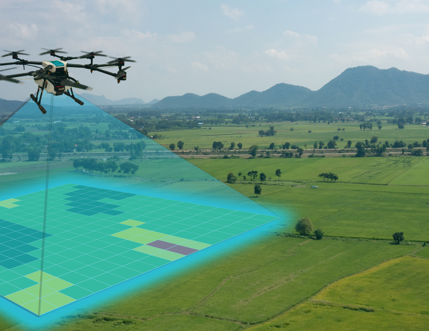
What was once a hobbyist’s gadget has become one of the most powerful tools in conservation. Drones are giving us a fresh way to look at ecosystems, monitor wildlife, and even plant forests. They can fly into places too remote or sensitive for people, collect data with remarkable accuracy, and return without leaving a footprint.
Imagine being able to track wetland water levels, count bird populations, or check a restoration berm without ever stepping into the field. That is what drones are doing every day for conservation teams. They are turning what used to take days of fieldwork into missions that can be completed in a matter of hours, often with a level of detail that was never possible before.
They are also helping scale reforestation. In Canada, drones planted more than 300,000 seed pods across multiple sites in just a few months. Some pods had germination success rates as high as 80 percent, showing what is possible when precision technology meets ecological restoration. Reforestation drones are particularly valuable in rugged terrain where crews cannot easily reach or where traditional planting would cause too much disturbance. By reducing labor costs and expanding reach, they make it possible to think bigger about restoring forests.
Wildlife managers are also getting creative. In Oregon, drones equipped with thermal cameras and speakers have been used to safely discourage wolves from hunting near livestock. Instead of relying on lethal measures, the drones simply play sounds such as human voices and even music that send the wolves moving along. Similar approaches are being tested in other regions to help manage species interactions in ways that reduce conflict while protecting biodiversity.
The applications go beyond reforestation and wildlife. Drones are now used to monitor water quality, track invasive plant spread, and survey wetlands for compliance with restoration permits. Their ability to collect consistent, repeatable data across large landscapes makes them invaluable for long term monitoring and adaptive management.
Of course, challenges remain. Batteries run out. Weather interferes. And not every seed pod survives. Training and technical expertise are also required, which can be a barrier for smaller organizations. But the progress is undeniable.
What drones bring to conservation is more than just new data. They bring scale. They bring speed. They bring accuracy. And most importantly, they bring the chance to see and manage ecosystems in ways we never could before.
As drone technology continues to evolve with longer flight times, more advanced sensors, and smarter software, the opportunities will only grow. For restoration professionals, that means faster results, stronger data, and a clearer path to meeting ecological goals.
If you want to learn how technologies like drones can enhance your restoration or conservation project, let’s connect here and explore the possibilities. Call or message us at (239) 633-8775 for immediate assistance.